City of Ardmore, OK President President@scaug.org Since 2000 I have been the GIS Coordinator for the City of Ardmore, OK. During that time I have been involved in managing and overseeing every aspect of municipal mapping, focusing heavily on GIS Implementation and its integration into 911, Surveying, Photogrammetry, Emergency, and Asset Management. I currently serve as the appointed Municipal Representative for the Oklahoma State GI Council as well as several other leadership roles throughout my local, state, and regional GIS community. Regardless of whether you have a whole GIS department with staff and a large budget or you are the one person shop with only a strong desire to work and a big job ahead of you, my goal has and always will be, to ensure that SCAUG is there to help you. At the end of the day my desire is for you to feel educated, successful, welcome, and appreciated by SCAUG. Personally I welcome your ideas to continue building on what SCAUG offers to the GIS community in order to insure SCAUG continues to be your professional home base for the future. |
OK Office of Geographic Information Vice President VicePresident@scaug.org Shellie Willoughby is the GIS Specialist for the Oklahoma Conservation Commission for which she has worked for the past 20 years. While working for the Oklahoma Conservation Commission she has been heavily involved in the coordination efforts of the Oklahoma GI Council as well as the Oklahoma Office of Geographic Information, where she currently serves as the Assistant State GIS Coordinator. Prior to working for the Conservation Commission, Shellie received a B.S. and M.S. degrees in Geography from Oklahoma State University. As a member of SCAUG for 19 years Shellie has served on the SCAUG Board in various positions for the past 14 years as well as held multiple positions in the Oklahoma Chapter of SCAUG, where she currently serves as Chair. Shellie loves to travel with her family and has been to 47 of the 50 states. When not at work Shellie can be found enjoying the great outdoors with the two favorite men in her life, her husband, Richard, and her 10 year old son, Andrew. |
Carter County, OK Treasurer Treasurer@scaug.org James Allen graduated from East Central University in 2005 with a Degree in Cartography/Geography. James has been employed as the GIS Coordinator for Carter County, OK for 7 years, and he also serves as the IT Director and various other jobs for the county. He has been a member of SCAUG for 10 years and has served as the regional Treasurer since 2011.
Principal Meridian Consulting Past President Joe Chapa is the current past president for SCAUG. Joe is president of Principal Meridian Consulting a company that speacializes on enterprise GIS and IT solutions. He was the Project Manager for the City of New Braunfels, Texas. He oversee the implementation and integration of Asset and Land Management with GIS. Prior to arriving to the City of New Braunfels, Joe was Director of GIS for the City of San Antonio. The team I managed developed and established an enterprise GIS system that included 36 department and 200+ GIS users.
City of Fort Worth Growing up in a military family, I always found myself being introduced to new places, and as a result I constantly had questions about how the environment around me actually worked. My quest for geographic knowledge landed me a Bachelor of Arts in Geomorphology from Arizona State University in 1993 and a Masters in Applied Geography from Southwest Texas State University in 1998. My career has allowed me to map natural resources along the Texas Coastal Bend for Texas Parks & Wildlife, and provide National Pollutant Discharge Elimination System geospatial support for the City of Dallas. Since 2000, I have managed the environmental GIS efforts and played an integral role in Emergency Management at the City of Fort Worth. On my down time I enjoy working in my yard, BBQing, and live music. I am an avid Texas Rangers fan, and proud mother of my beautiful daughter Jade Elizabeth.
GIS Nuts Louisiana Representative Leslie H. Morgan, Ph.D. has over 15 years of experience as a GIS professional. She is an independent GIS Consultant specializing in providing GIS analysis, support, and automation services to clients. Automation services may include the development of GIS workflows, custom GIS tools and/or GIS web applications. Leslie is an ESRI certified desktop associate and an ESRI certified trainer. Her educational background is in Biological Statistics, and she is currently adjunct faculty in the graduate school at Tulane University. Leslie has a real passion for GIS which she blogs about on her community GIS website, GISNuts.com. Leslie lives in central Louisiana, and she is very excited to be serving as the Louisiana State Representative for SCAUG.
Mendrop-Wages, LLC.  Karen Lizcano Karen LizcanoESRI - San Antonio ESRI Representative: Karen Lizcano has been a Solutions Engineer with Esri for the past five years. Karen attended Texas A&M University where she earned her BS in Geography. After graduation she worked for a local government office in Georgia where she gained experience in parcel mapping and editing, local government map production and Utility Mapping. Karen has also worked for a water utility and engineering company. She has experience and knowledge in ArcGIS Server, Mobile, Desktop and ArcGIS Online. | Tarrant County, TX Secretary Secretary@scaug.org
CPS Energy Conference Coordinator Elect Coordinatorelect@scaug.org I have been a member of SCAUG since 1996, an active Board member since 2005 when I first served as Conference Coordinator, went to serve as Texas Rep in 2006 and Conference Coordinator/Conference Coordinator Elect since 2007. As Conference Coordinator I believe having the Regional Conference in places SCAUG has never been or not been recently. Since 2006 work for CPS Energy in San Antonio, the largest municipally owned energy utility company in gas and electric as Manager responsible for GIS data of all new construction in San Antonio. Prior to CPS Energy retired from Bexar Appraisal District after 24 years of service. I’ve been actively learning GIS software since 1989 now successful in managing an Enterprise GIS System. With a Bachelors degree in Geography from UTSA, pursing a Masters degree from Texas State as time allows. I am active in local GIS User Groups, GIS Day, member of URISA, EGUG, WEN, AAG, coordinate meetings with the local Women in GIS known as WIGIS and Chairman of Cadre Facilitators for the San Antonio Woman’s Chamber of Commerce. As a Geographer I love to travel local and abroad meeting people and experiencing different cultures, as I like to phrase it “Discover New Earth Settings in Different Projections”.
Meshek & Associates Oklahoma Representative I'm a scientist at heart; and a bit of a tinkerer. I love using GIS to solve spatial problems. After earning my Master’s Degree in Geography in 2002, I began a career as a satellite imagery analyst; creating vegetation maps and performing other spatial analyses for wildlife biology studies at The University of Montana's Cooperative Wildlife Research Unit. In 2008 I continued my career, after starting a family and moving cross-country, with Meshek & Associates PLC where I now specialize in 3D data analysis, server applications, and mobile data collection technologies. I have been an active member of Oklahoma SCAUG since 2008, and have been a member of the SCAUG Executive board as the Oklahoma Representative since 2014. I aspire to bridge the gap between the GIS “Geeks" and “end-users” by presenting the technology in a way that everyone can relate to and understand. I believe Geography is the hub of many disciplines, and if applied correctly, can be the means by which we connect and make sense of them all. GIS is the grease on the axles of business!  Samantha Gorham Samantha GorhamGIS Inc. Samantha Gorham is a Sr. GIS Analyst for GISi supporting the Navy in Fort Worth, TX. She has been in the GIS industry for 13 years. Her GIS background is in oil and gas mapping, cadastral and supporting the Navy's GIS efforts. She has an Associate of Science from Richland College and is currently working on obtaining her GISP. "I am very excited to serve the North Texas region, and hope to connect more people in the region to SCAUG. I look forward to meeting everyone at future events and meetings."
MSD GIS Services South Texas Representative Shane Diaz is the owner/operator of his own company. He most recently was a GIS Administrator for a 9-1-1 District. He overlooked the day to day operations of the employees in preparing, creating and maintaining geospatial data as well as administering the data and projects. Along with this he also provided assistance to multiple agencies on a variety of other projects. With 14 plus years in GPS and GIS work he has helped maintain and develop survey, road, landscaping, water infiltration and 9-1-1 GIS data, as well as held positions with a number of government agencies manipulating data in developing GIS departments. Shane has been in the field as a Rodman, Instrument Man, Crew Chief, and GPS Tech and in the office as a Draftsman, GIS Specialist, GIS Manager, as well as GIS Administrator. Shane had the privilege of assisting in the recovery efforts for Space Shuttle Columbia as well as developing detailed data for some of our major hurricanes. He believes in creating the best data possible to serve our citizens. Shane is an avid horseman and a committee member of the Houston Livestock Show & Rodeo, where he enjoys giving back to the students through multiple scholarship awards, as well as riding in one of the oldest trail rides to kick off the HLSR and raise awareness for multiple organizations. |
 Charles E. Brady III, GISP
 Shellie Willoughby, GISP
 James Allen
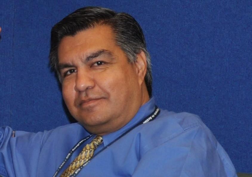 Joe Chapa, GISP
  Betsi Chatham
 Leslie Morgan, PhD.
 Lauralee Gann
 Anne Mackey, GISP
 Lydia Sauceda, GISP
 Willard Gustafson
 Shane Diaz